Cambusmore Rivers
Click here to make a booking for Cambusmore Rivers
Location using What3words (for parking) /// ticket.skate.super and then What3words (track to the rivers) forensic.essays.coiling
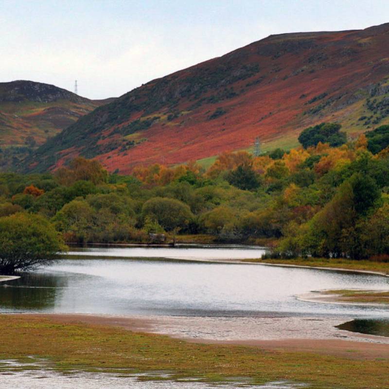
The club were asked in 2022 if we would sell permits for the new owners of the Fleet and Carnaig rivers that are adjacent to the Cambusmore Estate. We have 2 permits a day to sell on these waters that are classed as Category Three by the Scottish Government. There is no set rotation but good etiquette is required.
All the waters are "Category Three (3)" - meaning all migratory fish have to be returned to the water. There are no exceptions. Even if the fish is bleeding and may not survive - they all go back.
Fly fishing only between April 1st and September 30th.
There is no fishing below the sluice gates. Permits will be issued with a map together with the current rules. Please display the laminated sheet in your car windscreen, for the benefit of the river Bailiff
Notes and limits
Back up to map
Loch a' Ghiubhais
Click here to make a booking for Loch a' Ghiubhais
Location
Ordnance Survey map Sheet 21. Grid Reference 716930
or What3words (enter the whole sequence and navigate for the route) /// mental.storage.sonic /// roadways.alarm.collect /// spiking.districts.changing /// confirms.towel.longer /// aboard.spirit.scared /// confining.dragging.ports /// plan.skillet.painter /// idealist.walkway.alerting
Directions
Leave Dornoch on A949 to Evelix junction. Turn right on to the
A9 (North) and after 600yds (540M) take the first tarred road to the left at a signpost pointing to Astle. On reaching the Rearquhar junction at Astle hamlet 1.7 miles (2.7 Km) bear left at the fork, down across the river Evelix and on to the end of the Astle tarred road. A good forestry road now leads up to the loch. About halfway up to the loch there is a locked gate, which can be opened with the key provided with your fishing permit. There are plenty of places where cars can be parked by the side of the road. Access for forestry operations must not be impeded. The walk down to the loch is about 500yds. (450M) over rough ground through a plantation, but the best route is marked with white marker posts, which lead to a stile over a deer fence.
Description
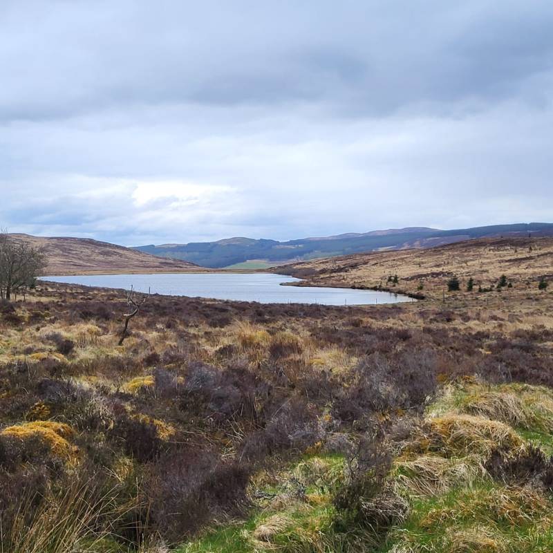
Loch Ghuibais is a very small, shallow, triangular shaped loch. Due to the lack of suitable spawning streams, it is doubtful if there are any true native trout left in the loch. However, the loch provides excellent feeding and the Association have stocked Ghuibais with hatchery reared brown trout on a regular basis and these fish have shown a good rate of growth. More recently, the fish put in the loch have been previously caught on Loch Lagain. The average weight caught would be over 1lb. with several over 2lb. taken each season.
Fish can be taken almost anywhere, the exception being the west end shore where the ground is very soft underfoot and unsuitable for walking upon. Wading is not necessary as good fish can be taken close in. Use standard loch flies but be prepared to search your fly box for a good imitation pattern when there is a hatch of naturals coming off the water.
NB: Care should be taken in crossing the inflow burn and along the edges of the right hand bank as parts are undercut and could give way underfoot.
Note: Because this is such a small loch the Association has restricted fishing to members and accompanied guests for bank fishing only. A visitor ticket is not available.
Notes and limits
Limited to two brown trout per rod. Members and their guests only.
Back up to map
Loch An Lagain
Click here to make a booking for Loch An Lagain
Location
Ordnance Survey map Sheet 21. Grid Reference 660955
or What3words (for the gate) ///companies.plodding.napkins
Directions
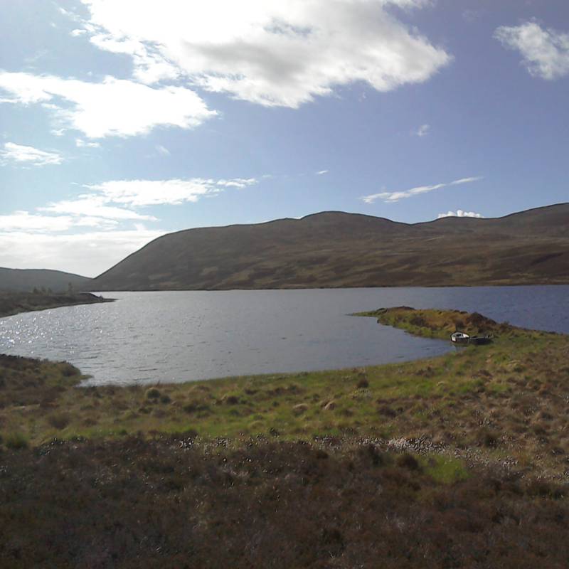
Leave Dornoch by the A949 and turn left onto the A9 (South) at Evelix junction. After 1 mile (1.6Km) leave the A9 by turning right, back onto the A949 (old A9) at the entrance to Clashmore village and continue to Spinningdale 6 miles (9.6 Km). Turn right in the middle of Spinningdale (on the long left hand bend) and travel up the Fairy Glen road until you come to the crossroads 3.5 miles (5.6Km). Turn right per the sign for Loch Buidhe and after 2 miles (3.2 Km) you will see Loch Lagain on your right. Continue over the small bridge crossing the An Uidh burn, and the track to Loch Lagain is on your right opposite the Sleastry Post Box. The club’s boat is berthed at the near end of the loch 0.6 miles (1 Km) and there is turning and parking space available.
Description
Lagain is a narrow triangular shaped loch with the apex at the far end where the river Evelix has its outflow. The loch holds a good stock of wild brown averaging about three to the pound although in 1993 a fish of 3lb. was taken. Fish can be caught all over the loch and standard loch patterns will serve you well. Some salmon enter Lagain in September and are caught from time to time, the favourite area being west end around the An Uidh burn. An outboard motor will be beneficial on this loch as it can be a long hard row back to the anchorage against a strong west wind. Fly Fishing only is permitted. This is an excellent loch for learners as the trout are usually fairly accommodating.
Notes and limits
No limits.
Back up to map
Loch Brora
Click here to make a booking for Loch Brora
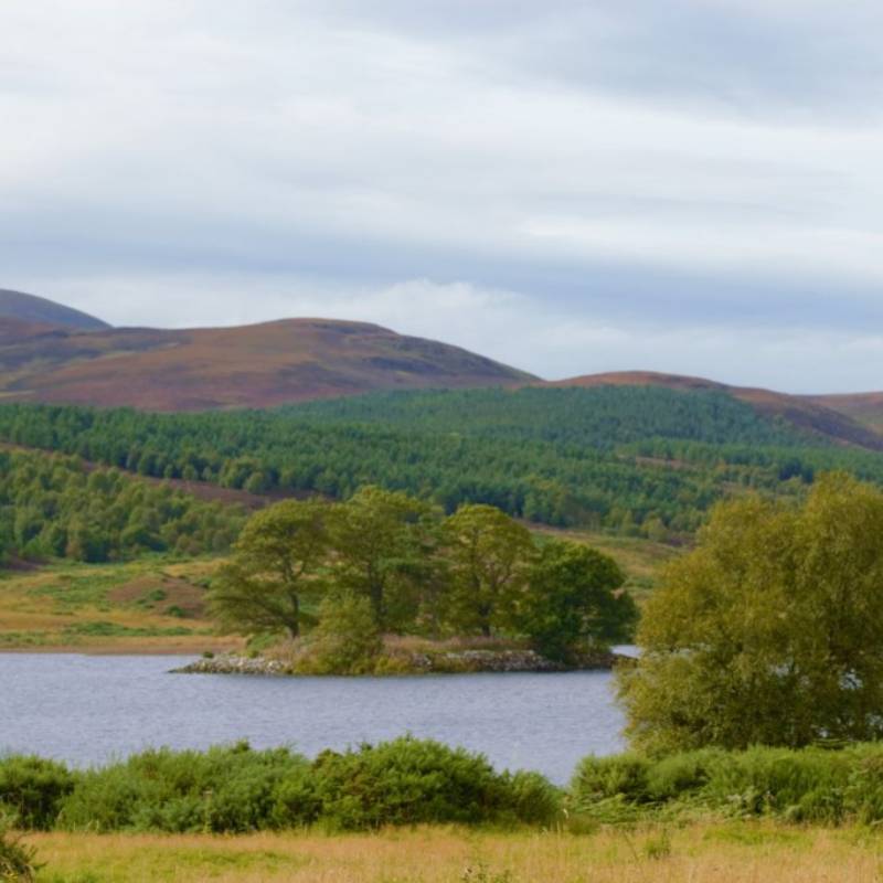
DDAA boat located at Gordonbush Bay
or What3words /// forgiving.equal.rails
The name Loch Brora covers three loch basins – Lower, Middle, and Upper which form part of the River Brora system. Brora contains wild brown trout averaging three to the pound, but ½ lb. fish are quite common and fish up to 3lb. are taken each year, with a specimen of 5lb. taken in 2017. Although brownies are spread throughout the loch, the Lower loch is considered the best. However it is for salmon and sea trout that Loch Brora is best known, with Spring and Autumn the favoured times when they are most frequently caught. The larger sea trout are best in May with finnock from July onwards and although like many sea trout fisheries, numbers have declined a lot over the past few years. In general Loch Brora is relatively shallow but with deep areas near the island on the lower loch, off the north east shore in the middle loch, and at the inflow of the river in the upper loch. Sea trout spread throughout the system and can be caught almost anywhere, but the salmon seem to prefer the upper loch fishing on Loch Brora is by boat and “fly only” is the rule. Bank fishing is Not allowed. Since 2019, the River Brora system is Category 1 – HOWEVER NO MIGRATORY FISH SHOULD BE KILLED.
Safety Note: Loch Brora is over 3 miles long and in a high wind, big waves can build up very quickly, especially in the more exposed areas. If using an outboard motor take care on the west side of the middle loch below Carol rock. There is a rocky reef here and although marked with a metal post, this can be difficult to see in poor light. The channel between the middle and upper lochs can also be difficult on occasions of low water.
Notes and limits
Salmon must be released. Only two sea trout for the season (bigger than 12" and lighter than 1lb 8oz). There is no limit for brown trout.
Overnight camping at Struan (at the lochside) is forbidden.
Back up to map
Loch Buidhe
Click here to make a booking for Loch Buidhe
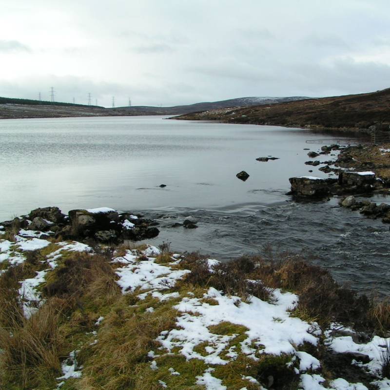
Location
Ordnance Survey map Sheet 21. Grid Reference 670980
or What3words /// directly.birdcage.crank with the boat moored at /// dolphins.mixes.carrots
Directions
Leave Dornoch on B9168 and join the A9 (North) and continue until you reach the south end of the mound causeway 6.2 miles (10Km). Turn left at the gatekeeper’s house where a signpost points to Loch Buidhe , 6miles
( 9.6Km). Parking is available at the dam end and the Association’s boat is berthed in a small bay on the far side, a walk of about 500yds. (450M).
Description
Buidhe is a rectangular shaped loch measuring about 1 1/4 miles (2 Km) long and ¼ mile wide, with a depth of 35 feet (11M). Because of its shape the loch can become rough in a high wind so exercise caution when out in a boat especially if you do not have an outboard motor. Buidhe holds a good stock of wild native brown trout averaging about ½lb. with bigger fish up to 1lb. taken each season. Trout can be caught all over the loch. Very good baskets can be taken in a good wave with the wind blowing from the East. A few salmon and sea trout enter late in the season, but if inadvertently caught they must be given in to the keeper at the Cambusmore Lodge as the Association does not have the fishing rights for these species. Bank fishing is permitted where marked east of the sign by the roadside and all of the north bank.
Notes and limits
No limits.
Back up to map
Loch Cracail Mor
Click here to make a booking for Loch Cracail Mor
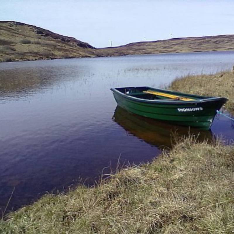
Location
Ordnance Survey map Sheet 16 Grid Reference 625020, and also map Sheet21 Grid Reference 635994
or What3words (for the gate) /// wide.bogus.beans then What3words (for the car park) /// schooling.smelter.gobblers and What3words (for the boat) /// marzipan.placed.teaches
Directions
Leave Dornoch by the A949 and turn left onto the A9 (South) at the Evelix junction. After 1 mile (1.6 Km) leave the A9 by turning right, back onto the A949 (old A9) at the entrance to Clashmore village and continue to Spinningdale 6 miles (9.6Km). Turn right in the middle of Spiningdale (on the left hand bend) and travel up the Fairy Glen road until you come to the crossroads 3.5 miles (5.6Km). Turn right per the sign for Loch Buidhe and after 2 miles (3.2Km) you will see Loch Lagain on your right. Continue on over the small bridge crossing the An Uidh burn and pass the track to Loch Lagain on your right opposite Sleastry Post Box. Continue for a further ½ mile (0.8Km) to a gate on the left hand side which leads to Garvery Croft. The turning is signposted "The Carneigie Road" and "Loch Laro". Pass through the gate (remembering to close it behind you) and continue along the track. Just before the second pylon line another track joins from the left (leading to Loch Laro). Continue straight on past this fork until you reach the first gate for at Garvery Croft, pass through this gate, (remembering to close the gate behind you) and continue to the second gate. The proprietors have kindly given permission to allow members and ticket holders to park their cars at this point, but you are requested to park off the track and keep it clear for the crofter. Do not attempt to take any vehicle past the second gate as the track is completely unsuitable. Proceed on foot along the track for a walk of approx. 30 minutes. Cracail Mor is the second loch you come to. The first loch, Cracail Beag is private water and the Association does not have fishing rights.
Description
Cracail Mor which is shaped like a long bow contains wild brown trout and is considered by many to be the best of the Association’s wild trout waters. The boat is berthed at the near end beside the stream that runs out of the loch and links with Cracail Beag. The loch contains a good stock of fish averaging about ¾ Lb. with fish up to 2lb. taken each season.
However Cracail Mor trout can be fickle and are not easy to catch. Use standard flies but also experiment as many of the bigger fish have fallen for less common flies such as Snipe & Purple, Green Nymph & Gold.
Safety note: If using an outboard motor take care as there is a skerry about one third of the way up the loch from the boat mooring and large boulders lie off the north shore. Bank fishing is NOT allowed.
Notes and limits
No limits.
Back up to map
Loch Lannsaidh
Click here to make a booking for Loch Lannsaidh
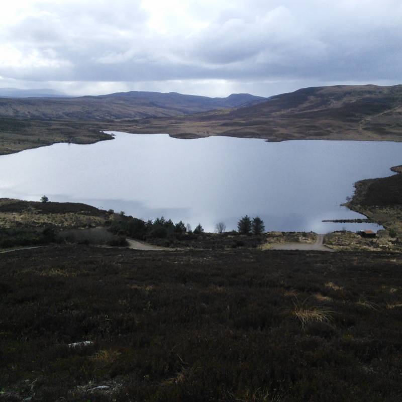
Location
Ordnance Survey map Sheet 21. Grid Reference 737945
or What3words (for the gate) /// extension.mango.gymnasium and for parking /// shook.chugging.times
Directions
Leave Dornoch by the A949 and turn right onto the A9 (north) at Evelix junction. Carry on for 0.8 miles (1.3 Km) then turn off left the A9 at the sign for Birichen. A little further on you will come to a “V” junction where you must take the right fork signposted Balvraid/Birichen. At the top of the hill you will see the Dornoch Water Pumping Station – a white building – away on your left. Carry on for another 200yds. (225M) and the track (tarred) leading to Loch Lannsaidh is on your left. You should see a croft directly opposite on your right hand side. After about 250yds.(225M) the track is closed off outside Londornaich croft house by a locked gate. You will be given a key for this gate when buying your fishing permit ticket. The track leads on directly to the loch and cars can be parked by the mooring place. The Association boats have three 15' fibreglass boats, two white "Captain Bob" and "Banks" and one green boat. The boathouse is equipped with table and chairs and provides a comfortable picnic facility, nearby is a bench and picnic table.
Description
Lannsaidh is a circular shaped loch and is typical of many of the local hill lochs in that the main banks consist of a top later of peat with heather and moss being the main vegetation. It is generally a shallow loch with a pot dropping to 30ft. (9.2M), out from the boat anchorage (as displayed on the map). In very warm weather, or cold water temperatures, the fish gather in this hole. The loch carries a good stock of native brown trout which average three to the pound with the occasional fish up to ¾ lb taken, although in 1996 a visitor reported taking a fish of 3lb. Lannsaidh is regularly stocked with Rainbows and Blues. Many of these are over 4lb. in weight with reports of even heavier fish been seen or breaking free. Standard patterns such as Loch Ordie; Kate McLaren; Peter Ross; Butcher etc. should do well in sizes 10 and 12, while reservoir lures could tempt rainbows. Bank fishing is permitted but fly only.
A 2 fish bag limit per angler applies to all stocked trout (Rainbows and Blues). There is no limit on brown trout. Anglers fishing from an anchored boat must give way to another boat fishing “THE DRIFT”.
Notes and limits
Limited to TWO stocked fish per rod and no limit for brown trout.
The landlord has requested that overnight camping is prohibited.
Back up to map
Loch Laoigh
Click here to make a booking for Loch Laoigh
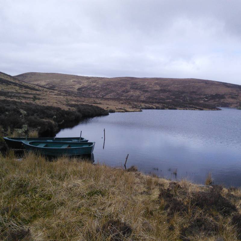
Location
Ordnance Survey map Sheet 21. Grid Reference 730960
or What3words (for the gate) /// extension.mango.gymnasium and for parking /// youngest.conspire.powder
Directions
The road through Cambusmore Estate land has deteriorated so much that anglers are requested to approach the loch through the Loch Lannsaidh entrance. (See Loch Lannsaidh page.) After the car park at Lannsaidh, there is a stock gate which must be closed after passing through. Keep on the track for about a mile until you reach the car park at the top of the hill. The track is useable by all vehicles, driven with care.
Depending on the height of the water, the boats will either be visible from the car park (A), or just round the right hand side of the main part of the loch (B).
The shed is equipped with a table and chairs and provides a comfortable picnic facility.
Description
Loch Laoigh is a narrow loch shaped like a figure 5. Although the banks of the loch are mainly of peat, the Ph level is neutral and the loch contains a good stock of native wild brown trout which average ½ lb. with the occasional fish of up to 3 lb. caught. The Association stocks Loch Laoigh on a regular basis with hatchery reared brown trout and these weigh in from ¾ to 1½ lb. and more. Trout can be caught all over the loch with the area around the island considered to be a particularly good spot.
Anglers must not land on the island, as it is a bird sanctuary. Furthermore from 15th March to 1st July anglers are requested to keep 30 yards (25M) off- shore when fishing off the island.
Standard loch patterns, sizes 10 to 14 work well, but do have a black fly on your cast. Bank fishing is permitted too, fly fish only.
Care: At times of low water, DO NOT pass between the island and the south east shore or you will ground on reef.
Notes and limits
Limited to four brown trout per rod.
Recently, the last part of the road, up the hill, has deteriorated quite a bit. Please exercise caution when driving up if you are in a car with low clearance.
The landlord has requested that overnight camping is prohibited.
Back up to map
Loch Laro
Click here to make a booking for Loch Laro
Location
Ordnance Survey map Sheet 21. Grid Reference 610 995
or What3words (for the gate) /// wide.bogus.beans
and What3words (for the boat) /// gravest.pampered.landed
Directions
Leave Dornoch by the A949 and turn left onto the A9 (South) at the Evelix junction. After 1 mile (1.6 Km) leave the A9 by turning right, back onto the A949 (old A9) at the entrance to Clashmore village and continue to Spinningdale 6 miles (9.6Km). Turn right in the middle of Spiningdale (on the left hand bend) and travel up the Fairy Glen road until you come to the crossroads 3.5 miles (5.6Km). Turn right per the sign for Loch Buidhe and after 2 miles (3.2Km) you will see Loch Lagain on your right. Continue on over the small bridge crossing the An Uidh burn and pass the track to Loch Lagain on your right opposite Sleastry Post Box.
Continue for a further ½ mile (0.8Km) to a gate on the left hand side which leads to Garvery Croft. The turning is signposted "The Carneigie Road" and "Loch Laro 4.5km". Pass through the gate (remembering to close it behind you) and continue along the track for about ¾ mile (1.2Km). Just before the second pylon line another track joins from the left (leading to Loch Laro).
The Association boat is berthed to the right of the new parking area (40yds) on the shore where a stream enters the loch.
Description
Loch Laro is roughly rectangular in shape and is generally fairly shallow but with a trench going down to a maximum of 27 ft. (8.2M) running the full length of the loch. The loch contains a good stock of wild brown trout averaging ½ lb. although there will be larger specimens in the deeper centre. Laro fishes best when the wind from either end, and baskets of six or more can be expected. Concentrate your efforts in the bays and along the margins. Standard loch patterns work well. Bank fishing is NOT permitted.
Notes and limits
No limits.
Back up to map